

By Arya Pratap Singh, Senior Applied Scientist.
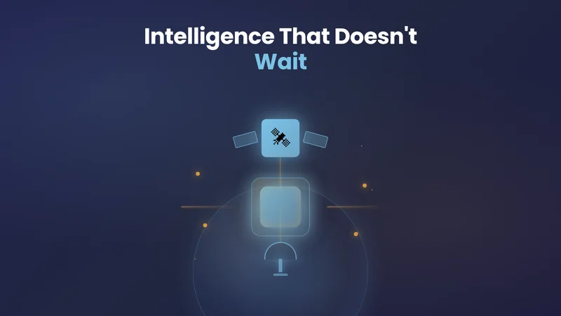
Somewhere over Toledo, Ohio, an earth observation satellite made a decision.
No ground station was listening. No human gave the command. Our payload processed a 489 MB scene of raw imagery, extracted every road in a 525 km² area, and compressed the result to less than 1% of the original data size, all in roughly two minutes.
By the time the satellite passed over a downlink window, the insight was ready to send. From observation to actionable insight: under 15 minutes.
This wasn’t just another lab demo. It came from an on-orbit implementation. And it represents something the Earth Observation industry has been chasing for years: intelligence that doesn’t wait.
The Numbers Demonstrate the Success
Before we explain why this matters for the world, here is exactly what happened over Toledo. KaleidEO’s OPT-series payload executed a road-network extraction algorithm fully autonomously in orbit. The results were downlinked and validated against reference data from OpenStreetMap.
| Parameter | Result |
|---|---|
| Region covered | ~525 km² (Toledo, Ohio, USA) |
| Input scene size | 489 MB GeoTIFF (5,209 × 24,530 pixels, 4-band, 1m resolution) |
| End-to-end on-orbit compute time | ~2 minutes (vs. ~3 hours ground processing) |
| Downlinked data size | ~1% of raw scene (vector road network only) |
| Time-to-actionable-insight | ~15 minutes from satellite pass (vs. 3–4 hours baseline) |
| Output quality | Road network validated over dense urban (Toledo city core) and sparse rural subsets |
| Execution autonomy | Fully autonomous, no ground commands during processing |
The Need of Faster Insights Access
The years 2025 and 2026 saw multiple instances globally which indicate the need of edge computing on satellites more than ever.
Between January 7 and 31, 2025, fourteen destructive wildfires swept through Southern California, forcing more than 200,000 people to evacuate, destroying over 18,000 structures, and burning more than 57,000 acres. A few months later, South Korea experienced its deadliest wildfire season on record, stretching from March through mid-May.
A subsequent paper in the Korean Journal of Remote Sensing put hard numbers on what delayed intelligence costs: polar-orbiting satellites logged detection delays of 197 to 305 minutes, three to five hours, while an AI-augmented geostationary system averaged 12.9 minutes. The gap between those two numbers is not an inconvenience.
The Core Problem of Latency
The dominant EO pipeline is structurally slow: a satellite captures an image, waits for a ground station window, which may not arrive for one to four hours, uploads the raw data, stages it, runs it through cloud compute, and eventually delivers it to an analyst.
In tactical scenarios, disaster response or security applications, that initial four-hour delay cascades into compounding decision delays. The intelligence arrives after the window to act has already closed, moving from action to analysis.
This model produces what we call a Planetary Memory: an archive of what has happened. Useful for climate science and urban planning, insufficient for a set of applications that needs insights to act swiftly!
The Rise of the Need for Sovereign Earth Observation Capability
Most EO providers address sovereignty through legal agreements: data-sharing clauses, jurisdiction provisions, shutter control policies. These matter. But they are ultimately reversible. A policy can be changed overnight; a legal agreement can be suspended by executive order.
The March 2025 Ukraine suspension was a live demonstration of that fragility. But it also catalysed a rethinking of what “sovereign EO” actually means at an architectural level.
| Region | Sovereignty Posture · 2025–2026 |
|---|---|
| 🇮🇳INDIA | Domestic satellite operators pivoted from commercial data sales to building sovereign assets for national sovereignty, a strategic stream driven by government demand for trusted EO infrastructure. |
| 🇪🇺EUROPE | Post-Ukraine geopolitics forced Europe to choose between collective efficiency and national control. Emergency coalitions replaced long-term planning, and sovereign EO capability moved to the top of defence agendas. |
| 🇯🇵JAPAN | In a historic first, Japan shared SAR technology with Ukraine, the first time the country had ever shared space-based intelligence with a foreign nation. |
| 🌍GLOBAL | 44 nations now plan sovereign EO constellations. Strategic dependency on Western space infrastructure is being actively unwound. |
From Processing to Action: The Rise of Autonomous EO
Faster processing is not the final destination for edge computing in space. It is the prerequisite for something larger: decision autonomy.
Space agencies have caught up to this vision. A 2026 challenge from a major government space programme explicitly called on the SmallSat community for mission concepts that leverage “adaptive sensing and onboard AI”, satellites that automatically increase resolution, change spectral bands, and trigger re-imaging when a high-interest event is detected. This is Agentic AI applied to Earth Observation: goal-driven systems that don’t wait for a ground operator. For instance, a wildfire monitor that detects a thermal anomaly and autonomously re-tasks itself for higher-resolution confirmation. A maritime payload that identifies an anomalous vessel pattern and triggers an inter-satellite relay alert. These are not science fiction stories anymore. They are the next engineering problem which organisations are already solving for.
The critical insight is that Agentic AI without Edge AI is incomplete. If every autonomous decision must wait for a cloud round-trip, the system is not acting, it is reacting, after a delay that may have already rendered the decision irrelevant.
The story of Edge AI in orbit is one of rapid escalation. It did not begin with full inference engines. It began with a much simpler question: can we at least stop transmitting clouds?
The early answer came from space agency demonstrators where AI-accelerator chips onboard experimental nano satellites automatically discarded cloudy images before the downlink, reducing wasted bandwidth and proving that a satellite can use edge AI for improving the TAT of last mile delivery of insights.
However, one major constraint these systems all navigate is the same which KaleidEO engineers are solving for: power.
Standard terrestrial GPUs draw 300–700W, exceeding the entire power budget of most LEO satellites, which typically run on 100–500W. Every watt spent on compute is a watt not spent on propulsion, comms, or payload. This is where specialized edge computers come into play, which typically use 1W (Intel VPU) to 50W at peak (Jetson or Unibap).
The Race Has Already Begun
What was experimental in 2023 is becoming operational in 2026. Satellites are now flying with multi-node compute environments where customers run AI models in orbit. Geospatial foundation models are executing inference in space. Contracts are following demos.
Planetary Memory vs. Planetary Intelligence
The dominant EO satellites produce Planetary Memory: an archive of what happened, delivered after the fact. Extraordinarily useful for climate science, urban planning, and historical analysis. But for the new world problems of climate change induced natural calamities accelerating climate disasters, and security applications requiring tactical decisions, memory is not enough.
Sovereign nations, defence agencies, and critical infrastructure operators need Planetary Intelligence: trusted decisions delivered in time to act on them. The path runs through three converging capabilities: on-orbit Edge AI, distributed LEOMs, and Agentic decision systems.
| Capability | Traditional EO | KaleidEO Edge AI |
|---|---|---|
| Sensor-to-insight latency | 1–4+ hours | Minutes |
| Raw data sovereignty | Data leaves orbit | Never leaves orbit |
| Bandwidth requirement | High (1–2 GB/image) | Minimal (structured output) |
| Autonomous re-tasking | Ground-operator dependent | Onboard agentic loop |
| Multi-modal fusion | Post-downlink only | LEOM-enabled in orbit |
| Contested environment | Link-dependent | Resilient by design |
At KaleidEO, our upstream philosophy is closely tied to our experience at SatSure building downstream applications where agility and timely access to data is the key.
To solve for the latency loop, KaleidEO’s OPT-series payloads have already demonstrated the On-Board AI processing at TRL 8. Rather than transmitting raw gigabytes of imagery per pass, the system transmits structured analytical outputs: detections, classifications, and analytics.
The Toledo result proved this in orbit: 489 MB of raw scene reduced to under 1% of its size, processed in ~2 minutes, ready to downlink as actionable insight within 15 minutes of the satellite pass! No additional ground stations, no wider downlink bandwidth, no extra cloud compute required.
Sources & References
-
Korean Journal of Remote Sensing (2025). Real-Time Wildfire Monitoring via Geostationary Satellite and AI: Insights from the March 2025 South Korea Wildfires. kjrs.org
-
TerraWatch Space Newsletter (Jan 2026). Earth Observation Outlook: Predictions for 2026. terrawatchspace.com
-
Via Satellite (Oct 2025). Geopolitics Drives Shifts in EO Business. satellitetoday.com
-
Space agency wildfire detection study (2025). How to Overcome Satellite Limitations in Early Wildfire Detection.
-
Space industry press (Nov 2025). Third AI-enabled satellite in orbit for a new era of edge intelligence. Industry reporting.
-
eoPortal (Dec 2023). AI-accelerated nanosatellite cloud-filtering mission. eoportal.org
-
IEEE / JPL (2025). Towards Space Edge Computing and Onboard AI for Real-Time EO.
-
SpaceNews (2025). U.S. halts satellite imagery support to Ukraine. spacenews.com
-
Defense.info (Aug 2025). Ukraine’s Expanding Satellite Intelligence Network. defense.info
-
IRIS France Policy Paper #122 (Jan 2026). European Spatial Intelligence. iris-france.org
-
SatNews (Jan 2026). Government space agency launches onboard AI challenge for SmallSat community. satnews.com
-
Market Reports World (2025). Earth Observation Satellite Market Size & Growth [2033]. marketreportsworld.com
-
TerraWatch Space Newsletter (Jan 2026). State of Commercial Earth Observation 2025 Edition. terrawatchspace.com
-
https://www.esa.int/Applications/Observing_the_Earth/ESA_and_IBM_collaborate_on_TerraMind
-
Science Collaborations Sparking New Applications With Geospatial Foundation Models
https://science.data.nasa.gov/learn/blog/prithvi-geospatial-model-applications